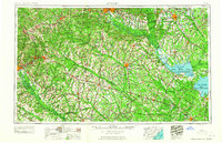
1961 Map of Augusta
USGS Topo · Published 1961About this map
Augusta and Columbia anchor this regional overview of the South Carolina and Georgia borderlands, a landscape defined by the convergence of the Savannah River and the sprawling waters of Lake Marion and Lake Moultrie. The mid-century footprint of the Savannah River Plant (Atomic Energy Commission) occupies a massive tract south of Aiken, signaling the era's Cold War industrial expansion. To the northeast, the Fort Jackson Military Reservation and Shaw Air Force Base further emphasize the significant federal and military presence in the region.
Find a feature on this map
239 named features on this map. Tap any name to fly to it.
Don’t see what you’re looking for? This feature index may not catch every label — zoom into the map to look around manually.
Map Details
Editions of this 1961 Augusta Map
2 editions found

Other maps of this area

1892 · Mc Cormick
USGS Topo · 1:125,000

1892 · Abbeville
USGS Topo · 1:125,000

1904 · Columbia
USGS Topo · 1:125,000

1908 · Kirksey
USGS Topo · 1:24,000

1912 · Mc Cormick
USGS Topo · 1:125,000

1918 · Walterboro
USGS Topo · 1:62,500

1918 · Varnville
USGS Topo · 1:62,500

1918 · Cottageville
USGS Topo · 1:62,500

1919 · Ladson
USGS Topo · 1:21,120

1919 · Gough
USGS Topo · 1:62,500