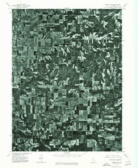
1975 Map of Augusta SW
USGS Topo · Published 1976About this map
Clayton and Timewell anchor this orthophotograph produced from aerial imagery captured in May 1975. The landscape is a stark study in mid-century Midwestern land use, defined by a rigid grid of rectangular farm plots and winding wooded drainage systems. The town of Clayton appears as a dense cluster of residential blocks and gardens, while Timewell sits at the edge of the photographic survey area. This specific type of map, an orthophotoquad, replaces traditional topographic symbols with an actual visual record of the ground, showing the exact footprint of farmsteads, windbreaks, and woodlots as they existed in the mid-1970s. It offers an exceptionally clear look at the agricultural patterns of eastern Adams County, documenting the state of rural infrastructure and field boundaries just before the further consolidation of contemporary industrial farming.
Find a feature on this map
2 named features on this map. Tap any name to fly to it.
Don’t see what you’re looking for? This feature index may not catch every label — zoom into the map to look around manually.
Map Details
Editions of this 1975 Augusta SW Map
This is the sole edition of this map. No revisions or reprints were ever made.
Other maps of this area

1925 · Liberty
USGS Topo · 1:62,500

1926 · Mt Sterling
USGS Topo · 1:62,500

1927 · Liberty
USGS Topo · 1:62,500

1929 · Mt Sterling
USGS Topo · 1:62,500

1946 · Augusta
USGS Topo · 1:62,500

1948 · Quincy
USGS Topo · 1:250,000

1948 · Camp Point
USGS Topo · 1:62,500

1949 · Augusta
USGS Topo · 1:62,500

1956 · Quincy
USGS Topo · 1:250,000

1958 · Burlington
USGS Topo · 1:250,000