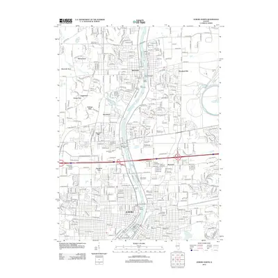
2012 Map of Aurora North
USGS Topo · Published 2012About this map
The Fox River bisects this landscape, creating a series of distinct islands that have shaped the urban development of Aurora and Batavia. Centrally located within the river is Stolp Island, a focal point of downtown Aurora, while further downstream sit Spiers Island, North Aurora Island, and Hurds Island. The suburban expansion of the early 21st century is evident in the burgeoning residential developments of Wenmoth Acres, Heritage West, and Woodland Hills, which contrast with the established academic and religious grounds of Mooseheart and Aurora University. The area is notably dense with commemorative spaces, featuring a concentration of burial grounds including Calvary Cem, Saint Joseph Catholic Cem, and the Pioneer Cem. The presence of the Bnsf Railway and the Batavia Wastewater Treatment Facility highlights the critical infrastructure supporting this corridor of the Fox River Valley as it appeared in 2012.
Find a feature on this map
401 named features on this map. Tap any name to fly to it.
Don’t see what you’re looking for? This feature index may not catch every label — zoom into the map to look around manually.
Map Details
Editions of this 2012 Aurora North Map
This is the sole edition of this map. No revisions or reprints were ever made.
Other maps of this area

1892 · Joliet
USGS Topo · 1:62,500

1908 · Wheaton
USGS Topo · 1:62,500

1923 · Joliet
USGS Topo · 1:62,500

1925 · Yorkville
USGS Topo · 1:62,500

1932 · Geneva
USGS Topo · 1:62,500

1948 · Wheaton
USGS Topo · 1:62,500

1948 · Geneva
USGS Topo · 1:62,500

1949 · Geneva
USGS Topo · 1:24,000

1950 · Aurora North
USGS Topo · 1:24,000

1953 · Naperville
USGS Topo · 1:24,000