
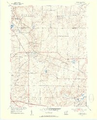
1953 Map of Aurora
USGS Topo · Published 1954About this map
The Aurora and Taborville area of Northeast Ohio is shown here during a transitional era of postwar expansion. A significant infrastructure landmark is the Ohio Turnpike Under Construction cutting across the southern portion of the map, signaling a new age of regional transit. This development contrasts with the established rural character of the land, which is dotted with sites like the Fowler Cem and Plainview Ch.
Find a feature on this map
32 named features on this map. Tap any name to fly to it.
Don’t see what you’re looking for? This feature index may not catch every label — zoom into the map to look around manually.
Map Details
Editions of this 1953 Aurora Map
2 editions found
Other maps of this area

1905 · Garrettsville
USGS Topo · 1:62,500

1906 · Kent
USGS Topo · 1:62,500

1906 · Chagrin Falls
USGS Topo · 1:62,500

1906 · Ravenna
USGS Topo · 1:62,500

1907 · Garrettsville
USGS Topo · 1:62,500

1908 · Chagrin Falls
USGS Topo · 1:62,500

1908 · Ravenna
USGS Topo · 1:62,500

1950 · Cleveland
USGS Topo · 1:250,000

1953 · South Russell
USGS Topo · 1:24,000

1953 · Chagrin Falls
USGS Topo · 1:24,000