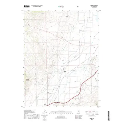
2020 Map of Aurora
USGS Topo · Published 2020About this map
The Sevier River valley serves as a focal point for agricultural and irrigation infrastructure, where the Piute Canal, Rocky Ford Canal, and Vermillion Canal form a complex network of water management near Aurora. This 2020 survey illustrates the town's grid settled between the river and the Aurora Cem, while the neighboring town of Salina sits to the east and Sigurd to the southwest. The landscape is defined by the sharp transition from the irrigated valley floor to the high elevations of the Valley Mountains and the Fishlake National Forest. Distinctive geological features like The Twist and Carter Peak dominate the southern quadrant, while Redmond Lake anchors the northern boundary, showing how contemporary settlement patterns remain bound to the traditional path of the river and the surrounding high desert terrain.
Find a feature on this map
55 named features on this map. Tap any name to fly to it.
Don’t see what you’re looking for? This feature index may not catch every label — zoom into the map to look around manually.
Map Details
Editions of this 2020 Aurora Map
This is the sole edition of this map. No revisions or reprints were ever made.
Other maps of this area

1885 · Manti
USGS Topo · 1:250,000

1885 · Beaver
USGS Topo · 1:250,000

1885 · Sevier Desert
USGS Topo · 1:250,000

1885 · Fish Lake
USGS Topo · 1:250,000

1895 · Manti
USGS Topo · 1:250,000

1896 · Fish Lake
USGS Topo · 1:250,000

1953 · Richfield
USGS Topo · 1:250,000

1953 · Delta
USGS Topo · 1:250,000

1956 · Salina
USGS Topo · 1:250,000

1956 · Price
USGS Topo · 1:250,000