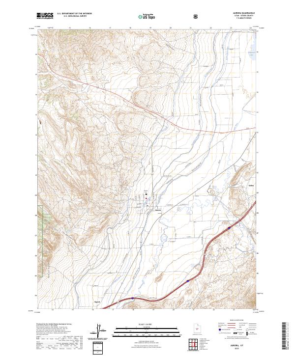
2023 Map of Aurora
USGS Topo · Published 2023About this map
Irrigation infrastructure and river valley settlements define the Sevier County landscape shown here. The Sevier River flows northward through the valley, supported by an extensive network of man-made waterways including the Vermillion Canal, Rocky Ford Canal, and Piute Canal. These systems provide the lifeblood for the agricultural corridor connecting the towns of Aurora, Redmond, Sigurd, and Salina. The topography transitions sharply from the level river bottoms to the elevated terrain of the Pahvant Range and the western edge of the Fishlake National Forest. Local history is anchored by the Aurora Cem and landmarks such as the Po in the town center. The map also traces intricate canyon features like Dry Red Canyon and Bald Knoll Canyon, while marking the transition into the southern geographic feature known as The Twist.
Find a feature on this map
51 named features on this map. Tap any name to fly to it.
Don’t see what you’re looking for? This feature index may not catch every label — zoom into the map to look around manually.
Map Details
Editions of this 2023 Aurora Map
This is the sole edition of this map. No revisions or reprints were ever made.
Other maps of this area

1885 · Manti
USGS Topo · 1:250,000

1885 · Beaver
USGS Topo · 1:250,000

1885 · Sevier Desert
USGS Topo · 1:250,000

1885 · Fish Lake
USGS Topo · 1:250,000

1895 · Manti
USGS Topo · 1:250,000

1896 · Fish Lake
USGS Topo · 1:250,000

1953 · Richfield
USGS Topo · 1:250,000

1953 · Delta
USGS Topo · 1:250,000

1956 · Salina
USGS Topo · 1:250,000

1956 · Price
USGS Topo · 1:250,000