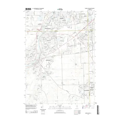
2015 Map of Aurora South
USGS Topo · Published 2015About this map
The Fox River corridor serves as the primary artery for this region, anchoring the communities of Aurora, Montgomery, and Oswego. This survey illustrates the dense suburbanization and complex jurisdictional boundaries where Kane, Kendall, DuPage, and Will Counties converge. Along the river, prominent landmarks like Hurds Island and Riverside Cem reflect long-standing local history, while the industrial and transportation legacy is marked by the Burlington Northern Santa Fe RR.
Find a feature on this map
127 named features on this map. Tap any name to fly to it.
Don’t see what you’re looking for? This feature index may not catch every label — zoom into the map to look around manually.
Map Details
Editions of this 2015 Aurora South Map
This is the sole edition of this map. No revisions or reprints were ever made.
Other maps of this area

1892 · Joliet
USGS Topo · 1:62,500

1908 · Wheaton
USGS Topo · 1:62,500

1923 · Joliet
USGS Topo · 1:62,500

1925 · Yorkville
USGS Topo · 1:62,500

1932 · Geneva
USGS Topo · 1:62,500

1948 · Wheaton
USGS Topo · 1:62,500

1948 · Geneva
USGS Topo · 1:62,500

1950 · Aurora North
USGS Topo · 1:24,000

1953 · Plattville
USGS Topo · 1:24,000

1953 · Naperville
USGS Topo · 1:24,000