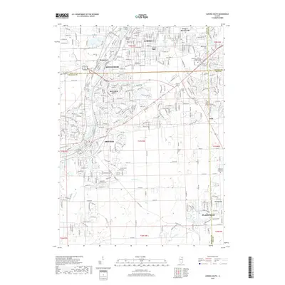
2018 Map of Aurora South
USGS Topo · Published 2018About this map
The Fox River corridor serves as the primary geographic anchor for this 2018 study, where the expanding urban footprints of Aurora, Montgomery, and Oswego converge. This area is notable for its concentration of historic burial grounds, ranging from large Catholic sites like Mount Olivet Catholic Cem and Saint Paul's Catholic Cem to smaller family and community landmarks such as Wormley Cem and Pearce Cem. The landscape reflects a transition from established riverfront centers to modern residential developments like Boulder Hill. Educational and recreational spaces are well-defined, including the Waubonsie Community College and South Park. Further south and east, the map traces the drainage of Morgan Cr and E Aux Sable Cr through the developing outskirts of Plainfield and Tamarack, illustrating the ongoing transformation of traditional Illinois farmland into suburban residential tracts.
Find a feature on this map
46 named features on this map. Tap any name to fly to it.
Don’t see what you’re looking for? This feature index may not catch every label — zoom into the map to look around manually.
Map Details
Editions of this 2018 Aurora South Map
This is the sole edition of this map. No revisions or reprints were ever made.
Other maps of this area

1892 · Joliet
USGS Topo · 1:62,500

1908 · Wheaton
USGS Topo · 1:62,500

1923 · Joliet
USGS Topo · 1:62,500

1925 · Yorkville
USGS Topo · 1:62,500

1932 · Geneva
USGS Topo · 1:62,500

1948 · Wheaton
USGS Topo · 1:62,500

1948 · Geneva
USGS Topo · 1:62,500

1950 · Aurora North
USGS Topo · 1:24,000

1953 · Plattville
USGS Topo · 1:24,000

1953 · Naperville
USGS Topo · 1:24,000