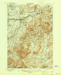
1903 Map of Ausable
USGS Topo · Published 1946About this map
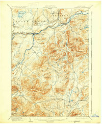
The Ausable River forms the industrial and geographic spine of this Adirondack region at the close of the nineteenth century. Industrial activity is evident at the village of Ausable Forks, where the West Branch Ausable River and East Branch Ausable River converge, and along the D. and H. R. R. rail corridor through Rogers and Clintonville. The landscape is dominated by high peaks including Jay Mountain and the distinctive Pokamoonshine Mt., which loom over small hamlets like North Jay and Ferrona. This period of surveying captures the transition from remote wilderness to a more settled landscape, marked by family-named landmarks like Mr. Fay and isolated settlements such as Towers Forge. Topographic details reveal a network of streams including Spruce Mill Brook and Oris Brook feeding into the Bouquet River to the south.
Find a feature on this map
75 named features on this map. Tap any name to fly to it.
Don’t see what you’re looking for? This feature index may not catch every label — zoom into the map to look around manually.
Map Details
Editions of this 1903 Ausable Map
7 editions found

Other maps of this area

1894 · Elizabethtown
USGS Topo · 1:62,500

1894 · Port Henry
USGS Topo · 1:62,500

1894 · Plattsburg
USGS Topo · 1:62,500

1895 · Willsboro
USGS Topo · 1:62,500

1895 · Elizabethtown
USGS Topo · 1:62,500

1895 · Mt. Marcy
USGS Topo · 1:62,500

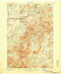
1895 · Ausable
USGS Topo · 1:62,500

1896 · Lake Placid
USGS Topo · 1:62,500

1898 · Port Henry
USGS Topo · 1:62,500

1898 · Lake Placid
USGS Topo · 1:62,500