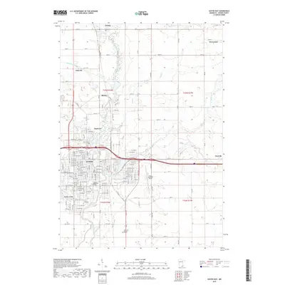
2019 Map of Austin East
USGS Topo · Published 2019About this map
The Cedar River corridor and its surrounding tributaries dictate the geography of Mower County in this modern topographic survey. The city of Austin dominates the southwest quadrant, showing a dense street grid that extends toward several smaller satellite communities, including Mapleview, Ramsey, and the residential pocket of Austin Acres. This era of the landscape is defined by the convergence of major waterways like Turtle Cr and Wolf Cr with developed infrastructure, evidenced by the Austin Municipal Airport and the preserved Historic Roosevelt Bridge over the river. For those tracing family histories or local development, the map identifies several significant burial grounds, from the large Oakwood Cem and Calvary Cem within the city limits to the northern Lansing Cem near the town of Lansing. The eastern portion of the quadrangle transitions into a more rural grid, connecting the city to Brownsdale and Nicolville via an extensive network of county highways and roads.
Find a feature on this map
102 named features on this map. Tap any name to fly to it.
Don’t see what you’re looking for? This feature index may not catch every label — zoom into the map to look around manually.
Map Details
Editions of this 2019 Austin East Map
This is the sole edition of this map. No revisions or reprints were ever made.
Other maps of this area

1954 · Hayward
USGS Topo · 1:62,500

1954 · Austin
USGS Topo · 1:62,500

1954 · Mason City
USGS Topo · 1:250,000

1957 · Mason City
USGS Topo · 1:250,000

1958 · Mason City
USGS Topo · 1:250,000

1966 · Waltham
USGS Topo · 1:24,000

1966 · Sargeant
USGS Topo · 1:24,000

1967 · Blooming Prairie
USGS Topo · 1:24,000
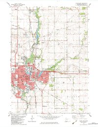
1982 · Austin East
USGS Topo · 1:24,000
1982 · London
USGS Topo · 1:24,000