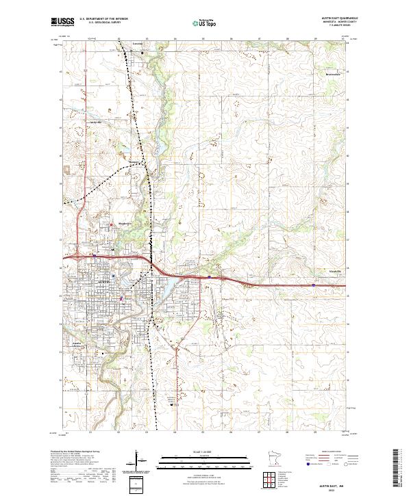
2022 Map of Austin East
USGS Topo · Published 2022About this map
The Cedar River corridor dominates the eastern side of Austin, serving as the primary geographic spine for the surrounding communities of Lansing, Ramsey, and Mapleview. This 2022 survey details the city's growth toward the Austin Municipal Airport and the smaller enclave of Nicolville to the east. The landscape is characterized by a dense concentration of commemorative sites, including Oakwood Cem and Calvary Cem, which provide significant anchor points for local genealogical research.
Find a feature on this map
47 named features on this map. Tap any name to fly to it.
Don’t see what you’re looking for? This feature index may not catch every label — zoom into the map to look around manually.
Map Details
Editions of this 2022 Austin East Map
This is the sole edition of this map. No revisions or reprints were ever made.
Historical Maps of Nicolville Through Time
4 maps found