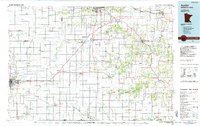
1985 Map of Austin
USGS Topo · Published 1985About this map
The Richard J Dorer Memorial Hardwood State Forest dominates the eastern portion of this regional survey, where the rugged topography of the Root River Valley contrasts with the surrounding agricultural plains. The landscape is defined by its drainage networks, including the North Branch Root River and South Fork Root River, which carve through the limestone terrain of the Driftless Area. Significant geological features such as the Niagara Cave and numerous quarries indicate the subterranean karst activity characteristic of this border region.
Find a feature on this map
106 named features on this map. Tap any name to fly to it.
Don’t see what you’re looking for? This feature index may not catch every label — zoom into the map to look around manually.
Map Details
Editions of this 1985 Austin Map
2 editions found
Other maps of this area

1906 · Decorah
USGS Topo · 1:125,000

1932 · Cochrane
USGS Topo · 1:62,500

1934 · Plainview
USGS Topo · 1:62,500

1934 · Cochrane
USGS Topo · 1:62,500

1935 · Rochester
USGS Topo · 1:48,000

1937 · Cochrane
USGS Topo · 1:62,500

1938 · Plainview
USGS Topo · 1:62,500

1939 · Rochester
USGS Topo · 1:62,500

1953 · Saint Paul
USGS Topo · 1:250,000

1953 · Eau Claire
USGS Topo · 1:250,000