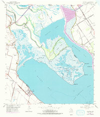
1952 Map of Austwell
USGS Topo · Published 1976About this map
The coastal wetlands of the Texas Gulf Coast define this area where the Guadalupe River fragments into numerous channels and bayous before reaching Guadalupe Bay. The settlement of Austwell sits near the junction of the Refugio and Calhoun county line, serving as a hub for the surrounding landscape of marshes and islands. Further inland, Long Mott is positioned along the Missouri Pacific railroad, highlighting the region's connection to inland trade routes during the early 1950s.
Find a feature on this map
50 named features on this map. Tap any name to fly to it.
Don’t see what you’re looking for? This feature index may not catch every label — zoom into the map to look around manually.
Map Details
Editions of this 1952 Austwell Map
Other maps of this area

1952 · Mosquito Point
USGS Topo · 1:24,000

1952 · Tivoli
USGS Topo · 1:24,000

1952 · Bloomington SW
USGS Topo · 1:24,000

1952 · Tivoli SE
USGS Topo · 1:24,000

1952 · Austwell
USGS Topo · 1:24,000

1952 · Seadrift
USGS Topo · 1:24,000

1952 · Port Lavaca West
USGS Topo · 1:24,000

1952 · Tivoli SW
USGS Topo · 1:24,000

1952 · Green Lake
USGS Topo · 1:24,000

1953 · Beeville
USGS Topo · 1:250,000