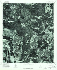
1975 Map of Autaugaville NE
USGS Topo · Published 1977About this map
The Alabama River winds through the southwestern corner of this orthophotograph, marking a landscape defined by its deep agricultural patterns and dense timberlands in the mid-1970s. The small settlement of Forester sits among a patchwork of cleared fields and forest, illustrating the rural character of Autauga County before further modern development. This unique aerial perspective, captured in December 1975, reveals the exact footprint of land use during this era, showing the distinct boundary between the river's floodplain and the upland farming tracts. Researchers can observe the intricate network of farm roads and drainage patterns that sustained this river-adjacent community.
Find a feature on this map
2 named features on this map. Tap any name to fly to it.
Don’t see what you’re looking for? This feature index may not catch every label — zoom into the map to look around manually.
Map Details
Editions of this 1975 Autaugaville NE Map
This is the sole edition of this map. No revisions or reprints were ever made.
Other maps of this area

1891 · Clanton
USGS Topo · 1:125,000

1901 · Wetumpka
USGS Topo · 1:125,000

1903 · Wetumpka
USGS Topo · 1:125,000

1927 · Montgomery
USGS Topo · 1:48,000

1930 · Montgomery
USGS Topo · 1:62,500

1953 · Montgomery
USGS Topo · 1:250,000

1956 · Montgomery
USGS Topo · 1:250,000

1957 · Montgomery
USGS Topo · 1:250,000

1957 · Autaugaville
USGS Topo · 1:62,500

1958 · Montgomery
USGS Topo · 1:62,500