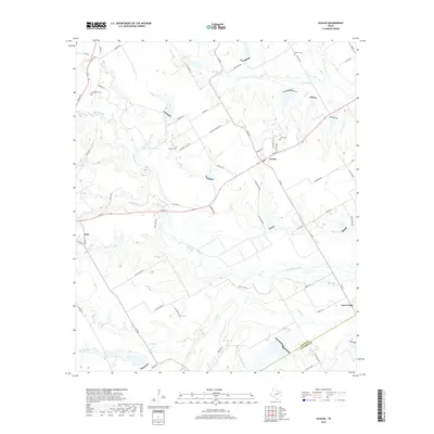
2019 Map of Avalon
USGS Topo · Published 2019About this map
Italy and Avalon anchor this 2019 survey of the central Texas blacklands, a region characterized by a complex network of creeks and legacy family landholdings. The map reveals the deep-rooted community history of Ellis and Navarro counties, tracing the path of Chambers Creek as it winds through the agricultural landscape. Genealogists will find significant value in the distribution of small burial grounds, including Forreston Cem, Hughes Cem, Dean Cem, and Maloney Cem, often situated near early roads like Hughes Cemetary Rd and Odom Rd.
Find a feature on this map
66 named features on this map. Tap any name to fly to it.
Don’t see what you’re looking for? This feature index may not catch every label — zoom into the map to look around manually.
Map Details
Editions of this 2019 Avalon Map
This is the sole edition of this map. No revisions or reprints were ever made.
Other maps of this area

1954 · Dallas
USGS Topo · 1:250,000

1956 · Ennis
USGS Topo · 1:62,500

1958 · Dallas
USGS Topo · 1:250,000

1960 · Boz
USGS Topo · 1:24,000

1961 · Forreston
USGS Topo · 1:24,000

1962 · Ennis West
USGS Topo · 1:24,000

1962 · Cryer Creek
USGS Topo · 1:24,000
1965 · Avalon
USGS Topo · 1:24,000
1965 · Blooming Grove
USGS Topo · 1:24,000
1965 · Italy
USGS Topo · 1:24,000