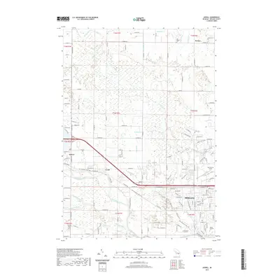
2019 Map of Averill
USGS Topo · Published 2019About this map
The Tittabawassee River winds through this central Michigan landscape, serving as the historical backbone for the settlements of Sanford, Averill, and the northwestern reaches of Midland. This 2019 survey captures the modern geography of the area, where former rail corridors have been repurposed into the Pere Marquette State Trail. The map is particularly rich for local historians and genealogists, documenting numerous burial grounds including Old Bombay Cem near the small community of Bombay, as well as Larkin Cem and the Midland Municipal Cem. An intricate network of agricultural and municipal drainage systems, such as Bensch Drain and Stems Drain, crisscrosses the township lines, revealing the engineered nature of the regional hydrology. Institutional and recreation landmarks also figure prominently, from the campus of Northwood University to the Midland City Forest and Jack Barstow Airport.
Find a feature on this map
98 named features on this map. Tap any name to fly to it.
Don’t see what you’re looking for? This feature index may not catch every label — zoom into the map to look around manually.
Map Details
Editions of this 2019 Averill Map
This is the sole edition of this map. No revisions or reprints were ever made.
Other maps of this area

1934 · Sanford
USGS Topo · 1:62,500

1936 · Sanford
USGS Topo · 1:62,500

1954 · Midland
USGS Topo · 1:250,000

1958 · Midland
USGS Topo · 1:250,000

1959 · Midland
USGS Topo · 1:250,000

1962 · Midland South
USGS Topo · 1:24,000

1962 · Midland North
USGS Topo · 1:24,000

1966 · Midland
USGS Topo · 1:250,000
1969 · Hope
USGS Topo · 1:24,000
1969 · Edenville
USGS Topo · 1:24,000