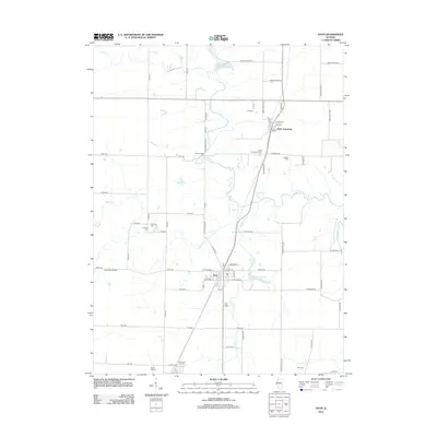
2012 Map of Avon
USGS Topo · Published 2012About this map
Avon and Saint Augustine anchor this section of the Illinois prairie, where the landscape is defined by a rigorous grid of section-line roads and the winding paths of Swan Cr and Cedar Cr. The map reveals a dense concentration of local heritage sites, particularly for genealogical research, with numerous small burial grounds scattered across the townships. From Hunt Cem in the north to the Old Prairie City Cem on the southern edge, these sites reflect the generations of farming families who settled this region. The terrain is lightly dissected by watercourses like Gallett Cr and Aylesworth Br, which break the geometric precision of the fields. Notable landmarks such as the Long RLA Airport and the Lake Avon Country Club Reservoir represent the modern development of local infrastructure and leisure in this agricultural heartland.
Find a feature on this map
57 named features on this map. Tap any name to fly to it.
Don’t see what you’re looking for? This feature index may not catch every label — zoom into the map to look around manually.
Map Details
Editions of this 2012 Avon Map
This is the sole edition of this map. No revisions or reprints were ever made.
Other maps of this area

1915 · Avon
USGS Topo · 1:62,500

1916 · Good Hope
USGS Topo · 1:62,500

1918 · Good Hope
USGS Topo · 1:62,500

1921 · Monmouth
USGS Topo · 1:62,500

1923 · Monmouth
USGS Topo · 1:62,500

1925 · Galesburg
USGS Topo · 1:62,500

1927 · Galesburg
USGS Topo · 1:62,500

1944 · Avon
USGS Topo · 1:62,500

1958 · Burlington
USGS Topo · 1:250,000

1961 · Burlington
USGS Topo · 1:250,000