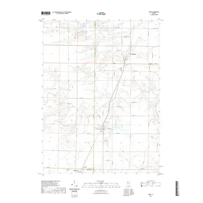
2021 Map of Avon
USGS Topo · Published 2021About this map
The borderlands of Fulton, Knox, Warren, and McDonough counties meet in this agricultural landscape centered on Avon, Illinois. The town sits at the intersection of local routes like S Main St and W Warren St, serving as a hub for the surrounding farm country. Further north, St. Augustine anchors the Knox County line, while Prairie City occupies the southern edge of the sheet. The terrain is defined by a dense network of drainage, where the headwaters of Cedar Creek and Swan Cr carve through the prairie, and Avondale Lake provides a notable water feature just east of Avon.
Find a feature on this map
70 named features on this map. Tap any name to fly to it.
Don’t see what you’re looking for? This feature index may not catch every label — zoom into the map to look around manually.
Map Details
Editions of this 2021 Avon Map
This is the sole edition of this map. No revisions or reprints were ever made.
Other maps of this area

1915 · Avon
USGS Topo · 1:62,500

1916 · Good Hope
USGS Topo · 1:62,500

1918 · Good Hope
USGS Topo · 1:62,500

1921 · Monmouth
USGS Topo · 1:62,500

1923 · Monmouth
USGS Topo · 1:62,500

1925 · Galesburg
USGS Topo · 1:62,500

1927 · Galesburg
USGS Topo · 1:62,500

1944 · Avon
USGS Topo · 1:62,500

1958 · Burlington
USGS Topo · 1:250,000

1961 · Burlington
USGS Topo · 1:250,000