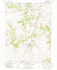
1974 Map of Avon
USGS Topo · Published 1978About this map
Avon serves as the central hub of this west-central Illinois landscape during the mid-1970s, situated at the junction of the Burlington Northern railroad and regional roadways. The survey reveals a community well-equipped with local infrastructure, including the Saunders Hospital and Avondale Lake. To the north, the village of St Augustine is marked by its own Water Tank and nearby St Augustine Cem, while the southern edge touches the outskirts of Prairie City.
Find a feature on this map
31 named features on this map. Tap any name to fly to it.
Don’t see what you’re looking for? This feature index may not catch every label — zoom into the map to look around manually.
Map Details
Editions of this 1974 Avon Map
This is the sole edition of this map. No revisions or reprints were ever made.
Other maps of this area

1915 · Avon
USGS Topo · 1:62,500

1916 · Good Hope
USGS Topo · 1:62,500

1918 · Good Hope
USGS Topo · 1:62,500

1921 · Monmouth
USGS Topo · 1:62,500

1923 · Monmouth
USGS Topo · 1:62,500

1925 · Galesburg
USGS Topo · 1:62,500

1927 · Galesburg
USGS Topo · 1:62,500

1944 · Avon
USGS Topo · 1:62,500

1958 · Burlington
USGS Topo · 1:250,000

1961 · Burlington
USGS Topo · 1:250,000