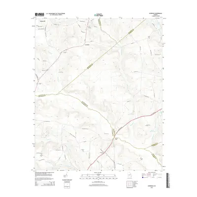
2014 Map of Avondale
USGS Topo · Published 2014About this map
Avondale and Adamsville anchor this 2014 survey of the rural landscape where Georgia's eastern counties meet. The terrain is defined by a dense network of family-named cemeteries and watercourses that trace the agricultural history of the region. Notable burial sites like Silver Run Cem, Woodland Cem, and Mt Horeb Cem are scattered across the landscape, providing essential touchpoints for genealogical research. The drainage patterns are dominated by Brier Cr and Boggy Gut Cr, which feed into larger water bodies such as George Claussen Pond and Euclid Claussen Pond. Of particular interest to industrial historians is the presence of Nortons Millrace near James Pond, indicating legacy water-management systems. The map also clearly delineates the complex borders where McDuffie, Richmond, Jefferson, Columbia, and Burke counties converge, illustrating how modern political boundaries overlie this older, creek-fed topography.
Find a feature on this map
75 named features on this map. Tap any name to fly to it.
Don’t see what you’re looking for? This feature index may not catch every label — zoom into the map to look around manually.
Map Details
Editions of this 2014 Avondale Map
This is the sole edition of this map. No revisions or reprints were ever made.
Other maps of this area

1919 · Gough
USGS Topo · 1:62,500

1920 · Stapleton
USGS Topo · 1:62,500

1922 · Harlem
USGS Topo · 1:62,500

1922 · Hephzibah
USGS Topo · 1:62,500

1948 · Hephzibah
USGS Topo · 1:62,500

1948 · Harlem
USGS Topo · 1:62,500

1948 · Stapleton
USGS Topo · 1:62,500

1948 · Gough
USGS Topo · 1:62,500

1948 · Blythe
USGS Topo · 1:24,000

1948 · Harlem
USGS Topo · 1:24,000