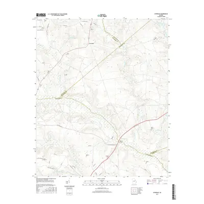
2017 Map of Avondale
USGS Topo · Published 2017About this map
Brier Cr winds through the borderlands where Richmond, McDuffie, and Jefferson Counties meet, anchoring a landscape defined by traditional family burials and rural industry. The small community of Avondale serves as a central point in this transition zone, surrounded by a high density of ancestral sites such as Silver Run Cem and Neal Cem. The topography reveals the historical reliance on local waterways, with Nortons Millrace and Patterson Bridge indicating where early settlers harnessed the terrain for movement and milling. This 2017 survey reflects the persistent rural character of the Georgia interior, where long-standing roads like Old Warrenton Rd and Deans Bridge Rd continue to trace the paths of previous generations near Lake Inez and George Claussen Pond.
Find a feature on this map
72 named features on this map. Tap any name to fly to it.
Don’t see what you’re looking for? This feature index may not catch every label — zoom into the map to look around manually.
Map Details
Editions of this 2017 Avondale Map
This is the sole edition of this map. No revisions or reprints were ever made.
Other maps of this area

1919 · Gough
USGS Topo · 1:62,500

1920 · Stapleton
USGS Topo · 1:62,500

1922 · Harlem
USGS Topo · 1:62,500

1922 · Hephzibah
USGS Topo · 1:62,500

1948 · Hephzibah
USGS Topo · 1:62,500

1948 · Harlem
USGS Topo · 1:62,500

1948 · Stapleton
USGS Topo · 1:62,500

1948 · Gough
USGS Topo · 1:62,500

1948 · Blythe
USGS Topo · 1:24,000

1948 · Harlem
USGS Topo · 1:24,000