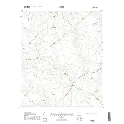
2020 Map of Avondale
USGS Topo · Published 2020About this map
Avondale sits at a geographic crossroads in eastern Georgia, where the boundaries of Richmond, McDuffie, and Jefferson counties converge. This 2020 survey documents a landscape defined by its riparian networks and family-named historical sites. The southern reaches of the map are characterized by significant water features, including Brier Cr and the Narrows Millrace, which feeds into James Pond. These watercourses have long dictated the placement of infrastructure like the Patterson Bridge and the nearby Patterson Cem.
Find a feature on this map
53 named features on this map. Tap any name to fly to it.
Don’t see what you’re looking for? This feature index may not catch every label — zoom into the map to look around manually.
Map Details
Editions of this 2020 Avondale Map
This is the sole edition of this map. No revisions or reprints were ever made.
Other maps of this area

1919 · Gough
USGS Topo · 1:62,500

1920 · Stapleton
USGS Topo · 1:62,500

1922 · Harlem
USGS Topo · 1:62,500

1922 · Hephzibah
USGS Topo · 1:62,500

1948 · Hephzibah
USGS Topo · 1:62,500

1948 · Harlem
USGS Topo · 1:62,500

1948 · Stapleton
USGS Topo · 1:62,500

1948 · Gough
USGS Topo · 1:62,500

1948 · Blythe
USGS Topo · 1:24,000

1948 · Harlem
USGS Topo · 1:24,000