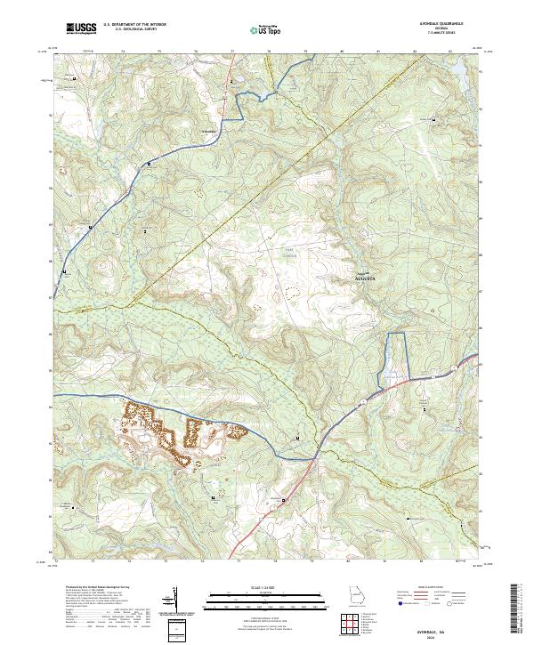
2024 Map of Avondale
USGS Topo · Published 2024About this map
Fort Gordon occupies a central position in this corner of Richmond County, where the military reservation borders numerous family-owned land tracts and rural cemeteries. The landscape is defined by the headwaters of several drainages, including Hard Fortune Creek and Brier Creek, which once powered local industry as evidenced by Nortons Millrace near the southern boundary.
Find a feature on this map
61 named features on this map. Tap any name to fly to it.
Don’t see what you’re looking for? This feature index may not catch every label — zoom into the map to look around manually.
Map Details
Editions of this 2024 Avondale Map
This is the sole edition of this map. No revisions or reprints were ever made.
Other maps of this area

1919 · Gough
USGS Topo · 1:62,500

1920 · Stapleton
USGS Topo · 1:62,500

1922 · Harlem
USGS Topo · 1:62,500

1922 · Hephzibah
USGS Topo · 1:62,500

1948 · Hephzibah
USGS Topo · 1:62,500

1948 · Harlem
USGS Topo · 1:62,500

1948 · Stapleton
USGS Topo · 1:62,500

1948 · Gough
USGS Topo · 1:62,500

1948 · Blythe
USGS Topo · 1:24,000

1948 · Harlem
USGS Topo · 1:24,000