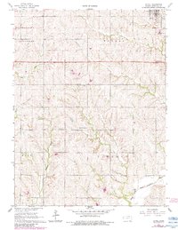
1966 Map of Axtell
USGS Topo · Published 1983About this map
Axtell sits in the northeast corner of this Marshall County survey, a concentrated hub of settlement defined by its connection to the Union Pacific railroad. The surrounding landscape is carved by an intricate network of waterways, including Snipe Creek, Guittard Creek, and the North Fork Black Vermillion River, which drain the varied topography of Guittard, Murray, Rock, and Lincoln townships.
Find a feature on this map
17 named features on this map. Tap any name to fly to it.
Don’t see what you’re looking for? This feature index may not catch every label — zoom into the map to look around manually.
Map Details
Editions of this 1966 Axtell Map
2 editions found
Other maps of this area

1889 · Seneca
USGS Topo · 1:125,000

1894 · Seneca
USGS Topo · 1:125,000

1955 · Manhattan
USGS Topo · 1:250,000

1956 · Manhattan
USGS Topo · 1:250,000

1957 · Manhattan
USGS Topo · 1:250,000
1966 · Seneca NW
USGS Topo · 1:24,000

1966 · Baileyville
USGS Topo · 1:24,000

1966 · Axtell
USGS Topo · 1:24,000
1966 · Summerfield
USGS Topo · 1:24,000
1966 · Beattie
USGS Topo · 1:24,000