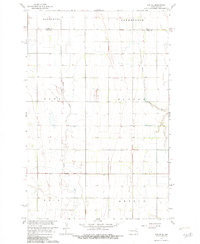
1967 Map of Ayr NE
USGS Topo · Published 1982About this map
The agricultural plains of the Red River Valley are defined here by the winding course of the Rush River and the South Branch Elm River as they meander through the townships of eastern North Dakota. Surveyed in the late 1960s, this landscape shows the organized grid of section lines and township boundaries that delineate Galesburg, Greenfield, Dows, Hunter, Erie, and Arthur. A solitary Gravel Pit near the center of the sheet indicates the small-scale local industry supporting road maintenance in this prairie region. The map captures a moment in the Missouri River Basin development, reflecting the systematic land use and hydraulic management characteristic of the era. The vast majority of the terrain is dedicated to cultivated fields, with only subtle elevation changes recorded by five-foot contours.
Find a feature on this map
10 named features on this map. Tap any name to fly to it.
Don’t see what you’re looking for? This feature index may not catch every label — zoom into the map to look around manually.
Map Details
Editions of this 1967 Ayr NE Map
2 editions found
Other maps of this area

1918 · Kelso
USGS Topo · 1:62,500

1943 · Kelso
USGS Topo · 1:62,500

1952 · Grand Forks
USGS Topo · 1:250,000

1956 · Grand Forks
USGS Topo · 1:250,000

1966 · Grand Forks
USGS Topo · 1:250,000

1966 · Galesburg
USGS Topo · 1:24,000

1967 · Ayr NE
USGS Topo · 1:24,000

1967 · Blanchard
USGS Topo · 1:24,000

1967 · Ayr NW
USGS Topo · 1:24,000
1967 · Hunter
USGS Topo · 1:24,000