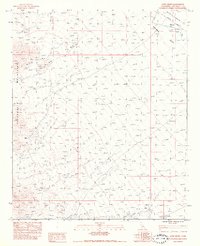
1983 Map of Aztec Mines
USGS Topo · Published 1983About this map
The Aztec Mines and an adjacent Prospect serve as focal points of activity within the arid landscape of the Chuckwalla Mountains during the early 1980s. This survey illustrates a topography defined by drainage patterns, where ephemeral watercourses like Ship Creek and numerous areas marked Dry Wash or Sand Wash cut through the terrain toward the Chuckwalla Valley. The map records a transition from traditional land uses to modern infrastructure, evidenced by the presence of a Double Wood Pole Powerline cutting across the northeast corner and a system of a Ditch and Dike managing runoff. Water remains a critical and scarce resource in this environment, with Chuckwalla Springs located near the southern boundary, providing a vital fixed point for mineral exploration and desert transit.
Find a feature on this map
14 named features on this map. Tap any name to fly to it.
Don’t see what you’re looking for? This feature index may not catch every label — zoom into the map to look around manually.
Map Details
Editions of this 1983 Aztec Mines Map
2 editions found
Other maps of this area

1940 · Iris Pass
USGS Topo · 1:62,500

1944 · Chuckwalla Mountains
USGS Topo · 1:62,500

1945 · Iris Pass
USGS Topo · 1:62,500

1952 · Sidewinder Well
USGS Topo · 1:62,500

1953 · Chuckwalla Spring
USGS Topo · 1:62,500

1954 · Salton Sea
USGS Topo · 1:250,000

1955 · Salton Sea
USGS Topo · 1:250,000

1959 · Salton Sea
USGS Topo · 1:250,000

1963 · Salton Sea
USGS Topo · 1:250,000
1963 · Iris Pass
USGS Topo · 1:62,500