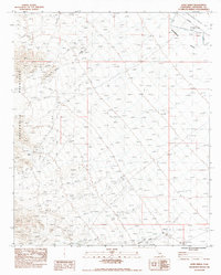
1983 Map of Aztec Mines
USGS Topo · Published 1988About this map
Aztec Mines sit at the edge of the high desert terrain in Riverside County, providing a detailed record of industrial and geological features during the early 1980s. The landscape is defined by the sharp transition between the Chuckwalla Mountains and the broad Chuckwalla Valley, where natural drainage systems like Ship Creek are ephemeral features identified as dry washes. This provisional survey captures the intersection of industrial expansion and the desert floor, marked by the presence of a Double Wood Pole Powerline and the Chuckwalla Road cutting across the valley. The map preserves the specific locations of mining operations and prominent landmarks such as Pilot Mtn., which served as a navigational point in this arid region before modern development altered the visibility of these remote sites.
Find a feature on this map
12 named features on this map. Tap any name to fly to it.
Don’t see what you’re looking for? This feature index may not catch every label — zoom into the map to look around manually.
Map Details
Editions of this 1983 Aztec Mines Map
2 editions found
Other maps of this area

1940 · Iris Pass
USGS Topo · 1:62,500

1944 · Chuckwalla Mountains
USGS Topo · 1:62,500

1945 · Iris Pass
USGS Topo · 1:62,500

1952 · Sidewinder Well
USGS Topo · 1:62,500

1953 · Chuckwalla Spring
USGS Topo · 1:62,500

1954 · Salton Sea
USGS Topo · 1:250,000

1955 · Salton Sea
USGS Topo · 1:250,000

1959 · Salton Sea
USGS Topo · 1:250,000

1963 · Salton Sea
USGS Topo · 1:250,000
1963 · Iris Pass
USGS Topo · 1:62,500