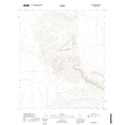
2019 Map of Babb Canyon
USGS Topo · Published 2019About this map
Babb Canyon and the surrounding high desert of Hudspeth County define this West Texas landscape, where life revolves around the management of water in an arid environment. The terrain rises to notable high points such as Little Flattop Mtn and the sprawling South Mesa, eventually reaching the sharp elevation change at Diablo Rim. The human footprint here is visible through a specialized network of tanks used for water storage, many bearing the names of local families and landmarks including McAdoo Tank, Patterson Tank, and Kuykendall Tank. These features, connected by remote routes like Big Tank Rd, illustrate the long-standing infrastructure required for ranching and survival in the Chihuahuan Desert highlands during the early twenty-first century.
Find a feature on this map
12 named features on this map. Tap any name to fly to it.
Don’t see what you’re looking for? This feature index may not catch every label — zoom into the map to look around manually.
Map Details
Editions of this 2019 Babb Canyon Map
This is the sole edition of this map. No revisions or reprints were ever made.
Other maps of this area

1895 · Sierra Blanca
USGS Topo · 1:125,000

1906 · Van Horn
USGS Topo · 1:125,000

1954 · Van Horn
USGS Topo · 1:250,000

1955 · Black Mountains
USGS Topo · 1:62,500

1958 · Van Horn
USGS Topo · 1:250,000

1973 · Bitter Well Mountain NW
USGS Topo · 1:24,000

1973 · Norton Mesa
USGS Topo · 1:24,000

1973 · Bitter Well Mountain SW
USGS Topo · 1:24,000

1973 · Sneed Mountain NE
USGS Topo · 1:24,000

1973 · Apache Peak
USGS Topo · 1:24,000