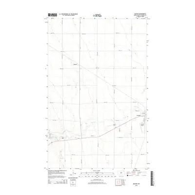
2014 Map of Backoo
USGS Topo · Published 2014About this map
Cavalier sits on the eastern edge of this agricultural landscape in Pembina County, where the sprawling grid of section lines meets the winding course of the Tongue River. The river forms a central corridor through the prairie, feeding into Lake Renwick near the small settlement of Akra. This 2014 survey documents a region defined by its transportation and aviation infrastructure, from the rural crossroads at Backoo to the Cavalier Municipal Airport and the private Hinkle Airport. State and county routes like Nd-5 and Co 12 serve as the primary arteries for this northern Red River Valley community, connecting isolated farmsteads and small clusters of homes across a wide-open terrain of drainage ditches and straight-line gravel roads.
Find a feature on this map
28 named features on this map. Tap any name to fly to it.
Don’t see what you’re looking for? This feature index may not catch every label — zoom into the map to look around manually.
Map Details
Editions of this 2014 Backoo Map
This is the sole edition of this map. No revisions or reprints were ever made.
Other maps of this area

1918 · Walhalla
USGS Topo · 1:62,500

1939 · Cavalier
USGS Topo · 1:62,500

1941 · Cavalier
USGS Topo · 1:62,500

1943 · Walhalla
USGS Topo · 1:62,500

1944 · Crystal
USGS Topo · 1:62,500

1952 · Thief River Falls
USGS Topo · 1:250,000

1956 · Thief River Falls
USGS Topo · 1:250,000

1957 · Thief River Falls
USGS Topo · 1:250,000

1964 · Mountain
USGS Topo · 1:24,000
1964 · Hensel
USGS Topo · 1:24,000