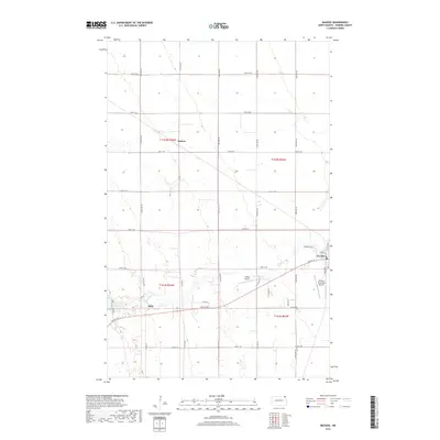
2017 Map of Backoo
USGS Topo · Published 2017About this map
The Tongue River meanders through the Pembina County landscape, anchoring the settlements of Akra and Cavalier. This 2017 survey shows the concentrated development of Cavalier in the southeast, characterized by a detailed street grid including Main St W and River St, alongside the Cavalier Municipal Airport. Further west, the community of Akra sits near the banks of the river and the marshy expanses of Lake Renwick. In the northern section of the map, the small settlement of Backoo marks a distinct point within the vast, section-lined agricultural fields. The transportation network is defined by a rigid system of section-line roads, such as 94th St NE and 138th Ave NE, which facilitate movement between these rural centers and isolated landmarks like Hinkle Airport.
Find a feature on this map
34 named features on this map. Tap any name to fly to it.
Don’t see what you’re looking for? This feature index may not catch every label — zoom into the map to look around manually.
Map Details
Editions of this 2017 Backoo Map
This is the sole edition of this map. No revisions or reprints were ever made.
Other maps of this area

1918 · Walhalla
USGS Topo · 1:62,500

1939 · Cavalier
USGS Topo · 1:62,500

1941 · Cavalier
USGS Topo · 1:62,500

1943 · Walhalla
USGS Topo · 1:62,500

1944 · Crystal
USGS Topo · 1:62,500

1952 · Thief River Falls
USGS Topo · 1:250,000

1956 · Thief River Falls
USGS Topo · 1:250,000

1957 · Thief River Falls
USGS Topo · 1:250,000

1964 · Mountain
USGS Topo · 1:24,000
1964 · Hensel
USGS Topo · 1:24,000