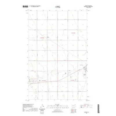
2020 Map of Backoo
USGS Topo · Published 2020About this map
Cavalier serves as a prominent focal point in this portion of Pembina County, marked by the presence of the Pembina County Courthouse and the nearby Cavalier Municipal Airport. The landscape is defined by the winding course of the Tongue River, which cuts through the southern sections of the area. Small, clustered settlements such as Backoo and Akra reflect the historical rural development patterns of the Red River Valley region, connected by a network of sectional roads and the Cavlandic Trail. The terrain is characterized by large agricultural plats and the occasional topographical variation of the Sandhill Ln area. Aviation infrastructure is notably present, with both the municipal facility and the smaller Hinkle Airport providing aerial access to this agricultural heartland in northeast North Dakota.
Find a feature on this map
70 named features on this map. Tap any name to fly to it.
Don’t see what you’re looking for? This feature index may not catch every label — zoom into the map to look around manually.
Map Details
Editions of this 2020 Backoo Map
This is the sole edition of this map. No revisions or reprints were ever made.
Other maps of this area

1918 · Walhalla
USGS Topo · 1:62,500

1939 · Cavalier
USGS Topo · 1:62,500

1941 · Cavalier
USGS Topo · 1:62,500

1943 · Walhalla
USGS Topo · 1:62,500

1944 · Crystal
USGS Topo · 1:62,500

1952 · Thief River Falls
USGS Topo · 1:250,000

1956 · Thief River Falls
USGS Topo · 1:250,000

1957 · Thief River Falls
USGS Topo · 1:250,000

1964 · Mountain
USGS Topo · 1:24,000
1964 · Hensel
USGS Topo · 1:24,000