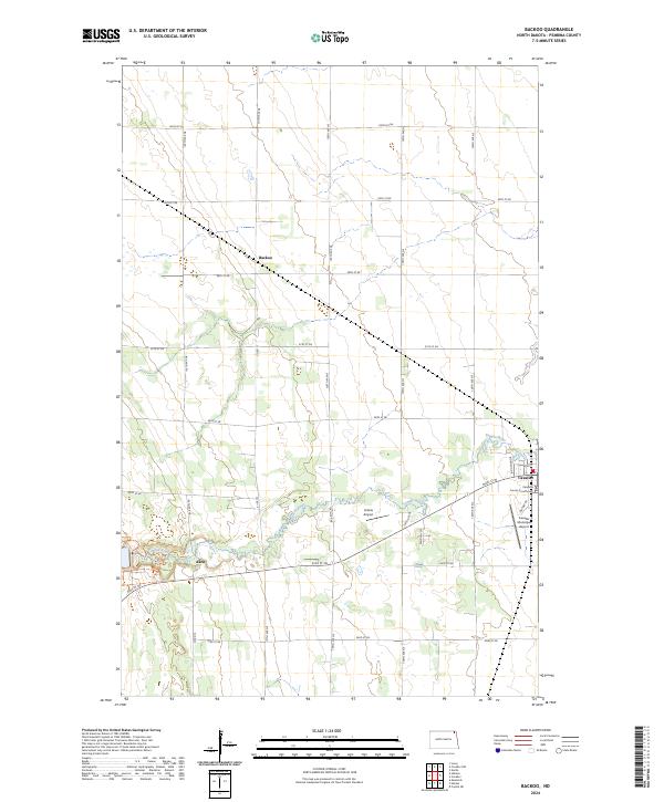
2024 Map of Backoo
USGS Topo · Published 2024About this map
The Tongue River meanders through this portion of Pembina County, connecting the small agrarian communities of Akra and Backoo with the regional hub of Cavalier. The landscape is defined by the rigid precision of the Public Land Survey System, with a dense grid of gravel roads like 98th St NE and 138th Ave NE carving the prairie into productive agricultural sections. In the southeast, Cavalier serves as the focal point of local governance and transportation, anchored by the Pembina County Courthouse. The area’s aviation history is visible through both the Cavalier Municipal Airport and the smaller Hinkle Airport to the west. This modern survey captures a landscape where the primary drainage of the river provides the only deviation from a perfectly gridded network of section lines and township boundaries like t162n r54w.
Find a feature on this map
30 named features on this map. Tap any name to fly to it.
Don’t see what you’re looking for? This feature index may not catch every label — zoom into the map to look around manually.
Map Details
Editions of this 2024 Backoo Map
This is the sole edition of this map. No revisions or reprints were ever made.
Other maps of this area

1918 · Walhalla
USGS Topo · 1:62,500

1939 · Cavalier
USGS Topo · 1:62,500

1941 · Cavalier
USGS Topo · 1:62,500

1943 · Walhalla
USGS Topo · 1:62,500

1944 · Crystal
USGS Topo · 1:62,500

1952 · Thief River Falls
USGS Topo · 1:250,000

1956 · Thief River Falls
USGS Topo · 1:250,000

1957 · Thief River Falls
USGS Topo · 1:250,000

1964 · Mountain
USGS Topo · 1:24,000
1964 · Hensel
USGS Topo · 1:24,000