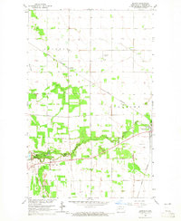
1964 Map of Backoo
USGS Topo · Published 1965About this map
Icelandic State Park and the winding Tongue River define the southern landscape of this mid-1960s North Dakota survey. The small settlements of Akra and Backoo serve as local hubs along the Great Northern railroad line, which cuts diagonally across the prairie. This map provides a clear view of the region's mid-century infrastructure and rural recreation, featuring the Renwick Dam, a Drive-in Theater, and the Hornbaker Airport. Local governance and aviation are further marked by the Townhall in Backoo and the Cavalier Airport further east. The abundance of Gravel Pits and a Sandpit near the river suggests the importance of local material extraction for road building and maintenance in Pembina County during this era.
Find a feature on this map
17 named features on this map. Tap any name to fly to it.
Don’t see what you’re looking for? This feature index may not catch every label — zoom into the map to look around manually.
Map Details
Editions of this 1964 Backoo Map
This is the sole edition of this map. No revisions or reprints were ever made.
Other maps of this area

1918 · Walhalla
USGS Topo · 1:62,500

1939 · Cavalier
USGS Topo · 1:62,500

1941 · Cavalier
USGS Topo · 1:62,500

1943 · Walhalla
USGS Topo · 1:62,500

1944 · Crystal
USGS Topo · 1:62,500

1952 · Thief River Falls
USGS Topo · 1:250,000

1956 · Thief River Falls
USGS Topo · 1:250,000

1957 · Thief River Falls
USGS Topo · 1:250,000

1964 · Mountain
USGS Topo · 1:24,000
1964 · Hensel
USGS Topo · 1:24,000