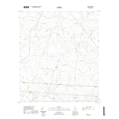
2020 Map of Baden
USGS Topo · Published 2020About this map
The borderlands of southern Georgia and the Florida panhandle are defined here by a network of rural settlements and agricultural drainage basins. Baden and Empress serve as local hubs in Brooks County, connected by a grid of county roads such as Empress Rd and Baden Rd. The landscape is dominated by the flow of Piscola Creek and its various tributaries, which feed into smaller basins like Denmark Lake and Childers Pond. Genealogists will find significant value in the documentation of family-named landmarks and local burial grounds, including the Johson Cem, Union Cem, and Worn Cem. South of the state line, the settlement of Lovett sits within Madison County, Florida. This survey captures the quiet continuity of this timber and farming region, marked by the presence of longtime local residents like Jeff Kinsey and scattered rural churches such as those along St Phillips Church Rd.
Find a feature on this map
66 named features on this map. Tap any name to fly to it.
Don’t see what you’re looking for? This feature index may not catch every label — zoom into the map to look around manually.
Map Details
Editions of this 2020 Baden Map
This is the sole edition of this map. No revisions or reprints were ever made.
Other maps of this area

1954 · Valdosta
USGS Topo · 1:250,000

1956 · Grooverville
USGS Topo · 1:24,000

1956 · Nankin
USGS Topo · 1:24,000

1956 · Baden
USGS Topo · 1:24,000

1958 · Valdosta
USGS Topo · 1:250,000

1959 · Valdosta
USGS Topo · 1:250,000

1960 · Cherry Lake
USGS Topo · 1:24,000

1961 · Quitman
USGS Topo · 1:62,500

1961 · Ousley
USGS Topo · 1:24,000

1962 · Ashville
USGS Topo · 1:24,000