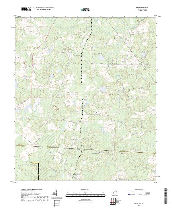
2024 Map of Baden
USGS Topo · Published 2024About this map
Baden and Empress sit within a landscape defined by the lowlands and agricultural tracts of the Georgia-Florida borderlands. This contemporary survey details the transition between Brooks County, Georgia, and its southern neighbors, Madison and Jefferson counties in Florida. The terrain is marked by a high density of rural burial sites, including Worn Cem, Union Cem, and Radford Denson Cem, offering significant value for genealogical research in this bi-state corridor. Water features such as Piscola Creek and Pine Branch wind through the region, feeding into localized bodies like Purdy Lake and Childers Pond. The map also identifies the Farm Service Agency Interest of Georgia, highlighting the ongoing managed land use and conservation efforts that characterize this rural border region.
Find a feature on this map
72 named features on this map. Tap any name to fly to it.
Don’t see what you’re looking for? This feature index may not catch every label — zoom into the map to look around manually.
Map Details
Editions of this 2024 Baden Map
This is the sole edition of this map. No revisions or reprints were ever made.
Other maps of this area

1954 · Valdosta
USGS Topo · 1:250,000

1956 · Grooverville
USGS Topo · 1:24,000

1956 · Nankin
USGS Topo · 1:24,000

1956 · Baden
USGS Topo · 1:24,000

1958 · Valdosta
USGS Topo · 1:250,000

1959 · Valdosta
USGS Topo · 1:250,000

1960 · Cherry Lake
USGS Topo · 1:24,000

1961 · Quitman
USGS Topo · 1:62,500

1961 · Ousley
USGS Topo · 1:24,000

1962 · Ashville
USGS Topo · 1:24,000