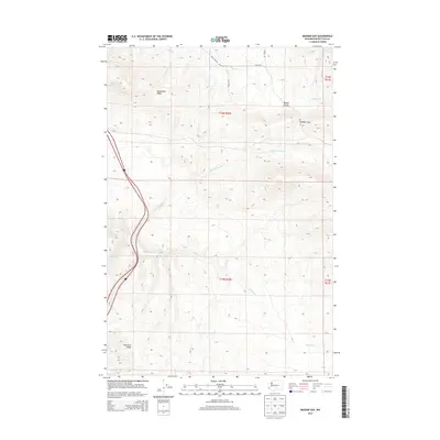
2013 Map of Badger Gap
USGS Topo · Published 2013About this map
Manastash Ridge and Umtanum Ridge dominate this section of the Kittitas County interior, defining a landscape of high crests and drainage basins. The map illustrates the topographical transition between these major ridges, featuring the distinctive pass at Badger Gap and the low-lying Badger Pocket to the northeast. Water management is central to the area's geography, visible in the path of the Pump Ditch and the various branches of Lmuma Cr and Badger Cr that carve through the upland terrain. The western edge of the sheet is defined by the dual corridors of Interstate 82 and US Route 97, which skirt the base of the ridges. Local roads like Upper Badger Pocket Rd and Silica Rd provide access to the rural pockets and high plateaus that characterize this part of Washington.
Find a feature on this map
18 named features on this map. Tap any name to fly to it.
Don’t see what you’re looking for? This feature index may not catch every label — zoom into the map to look around manually.
Map Details
Editions of this 2013 Badger Gap Map
This is the sole edition of this map. No revisions or reprints were ever made.
Other maps of this area

1936 · Yakima East
USGS Topo · 1:48,000

1936 · Hog Ranch Buttes
USGS Topo · 1:48,000

1938 · Badger Pocket
USGS Topo · 1:48,000

1939 · Boylston
USGS Topo · 1:48,000

1941 · Black Rock Spring
USGS Topo · 1:62,500

1941 · Yakima East
USGS Topo · 1:62,500

1943 · Boylston
USGS Topo · 1:62,500

1943 · Badger Pocket
USGS Topo · 1:62,500

1950 · Yakima
USGS Topo · 1:250,000

1953 · McDonald Spring
USGS Topo · 1:24,000