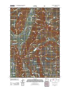
2011 Map of Badger Lake
USGS Topo · Published 2011About this map
Lookout Mountain and the high ridges of the Cascades dominate this 2011 survey, revealing a landscape defined by water management and mountain recreation. The Badger Lake Dam regulates Badger Lake, while nearby smaller water bodies like Jean Lake, Spinning Lake, and Little Boulder Lake dot the elevations. The map tracks a network of forest roads, including Bennett Pass Rd and Grasshopper Rd, which provide access to remote outposts like the Valley View Cabin and Nottingham Campground. The terrain is marked by distinctive topographical features such as Gunsight Butte, Badger Butte, and the Gumjuwac Saddle. Numerous springs and creeks, including Dog River Springs and Jack Springs, emphasize the area's role as a vital watershed. Named clearings and meadows like Horsethief Meadows and Bonney Meadows offer specific points of interest for those studying the local geography of Wasco County.
Find a feature on this map
60 named features on this map. Tap any name to fly to it.
Don’t see what you’re looking for? This feature index may not catch every label — zoom into the map to look around manually.
Map Details
Editions of this 2011 Badger Lake Map
This is the sole edition of this map. No revisions or reprints were ever made.
Other maps of this area

1924 · Mount Hood
USGS Topo · 1:125,000

1927 · Mount Hood
USGS Topo · 1:125,000

1930 · Dufur
USGS Topo · 1:125,000

1934 · Dufur
USGS Topo · 1:125,000

1953 · The Dalles
USGS Topo · 1:250,000

1956 · The Dalles
USGS Topo · 1:250,000

1956 · Mt. Wilson
USGS Topo · 1:62,500

1957 · The Dalles
USGS Topo · 1:250,000

1962 · Rock Creek Reservoir
USGS Topo · 1:24,000

1962 · Cathedral Ridge
USGS Topo · 1:24,000