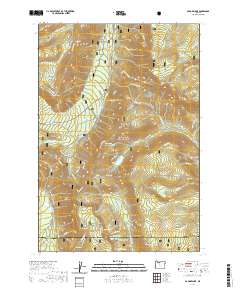
2020 Map of Badger Lake
USGS Topo · Published 2020About this map
Mount Hood National Forest defines the high-altitude landscape of this 2020 survey, where the Cascades' eastern slopes drop toward the high desert. The terrain is characterized by a series of prominent ridges and basins, most notably Bluegrass Ridge and High Prairie. Water resources are abundant throughout the quadrangle, with high mountain lakes like Jean Lake, Boulder Lake, and Spinning Lake serving as focal points for the backcountry. The map documents protected river corridors including the East Fork Hood Wild and Scenic River and the Fifteenmile Creek Wild and Scenic River. Seasonal use of the land is evident in the extensive network of winter-specific routes, such as Meadows Creek Ski (Snow) and Bennett Pass Ski (Snow), which provide access to peaks like Elk Mtn and Gunsight Butte.
Find a feature on this map
79 named features on this map. Tap any name to fly to it.
Don’t see what you’re looking for? This feature index may not catch every label — zoom into the map to look around manually.
Map Details
Editions of this 2020 Badger Lake Map
This is the sole edition of this map. No revisions or reprints were ever made.
Other maps of this area

1924 · Mount Hood
USGS Topo · 1:125,000

1927 · Mount Hood
USGS Topo · 1:125,000

1930 · Dufur
USGS Topo · 1:125,000

1934 · Dufur
USGS Topo · 1:125,000

1953 · The Dalles
USGS Topo · 1:250,000

1956 · The Dalles
USGS Topo · 1:250,000

1956 · Mt. Wilson
USGS Topo · 1:62,500

1957 · The Dalles
USGS Topo · 1:250,000

1962 · Rock Creek Reservoir
USGS Topo · 1:24,000

1962 · Cathedral Ridge
USGS Topo · 1:24,000