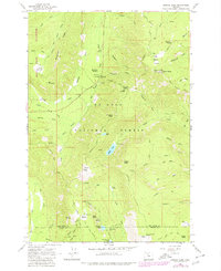
1979 Map of Badger Lake
USGS Topo · Published 1979About this map
Mt Hood National Forest dominates this topographic study, where the boundary between Hood River Co and Wasco Co bisects the high-elevation terrain. The map captures a high-mountain landscape defined by its network of trails and primitive administrative sites, including the Robinhood Guard Sta and the Valley View Cabin. The topography is shaped by water and ice, from the Newton Clark glacier in the west to the numerous alpine lakes such as Badger Lake, Jean Lake, and Spinning Lake further east.
Find a feature on this map
66 named features on this map. Tap any name to fly to it.
Don’t see what you’re looking for? This feature index may not catch every label — zoom into the map to look around manually.
Map Details
Editions of this 1979 Badger Lake Map
This is the sole edition of this map. No revisions or reprints were ever made.
Other maps of this area

1924 · Mount Hood
USGS Topo · 1:125,000

1927 · Mount Hood
USGS Topo · 1:125,000

1930 · Dufur
USGS Topo · 1:125,000

1934 · Dufur
USGS Topo · 1:125,000

1953 · The Dalles
USGS Topo · 1:250,000

1956 · The Dalles
USGS Topo · 1:250,000

1956 · Mt. Wilson
USGS Topo · 1:62,500

1957 · The Dalles
USGS Topo · 1:250,000

1962 · Rock Creek Reservoir
USGS Topo · 1:24,000

1962 · Cathedral Ridge
USGS Topo · 1:24,000