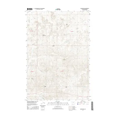
2017 Map of Badger Peak
USGS Topo · Published 2017About this map
Lame Deer sits at the southern edge of this landscape, where the valley of Alderson Cr meets the rising terrain of the northern Cheyenne country. The area is defined by a dense network of drainages and coulees, including West Fork Downey Coulee and Downey Coulee, which carve through the high ground. Distinctive landmarks such as Badger Peak and Charlie Black Butte provide prominent vertical relief against the surrounding hills. Water sources are critical features in this arid environment, evidenced by named points like Diamond R Spring and Mud Springs. The presence of Alderson Ca Rd and Old Poacher Ln shows the limited but vital road network connecting the drainage systems of Kelly Cr and Rye Grass Cr. This map captures the intricate topography of the Lame Deer District before modern expansion, highlighting the named gulches and springs essential to local land use.
Find a feature on this map
25 named features on this map. Tap any name to fly to it.
Don’t see what you’re looking for? This feature index may not catch every label — zoom into the map to look around manually.
Map Details
Editions of this 2017 Badger Peak Map
This is the sole edition of this map. No revisions or reprints were ever made.
Other maps of this area

1954 · Hardin
USGS Topo · 1:250,000

1957 · Hardin
USGS Topo · 1:250,000

1958 · Hardin
USGS Topo · 1:250,000

1958 · Garfield Peak
USGS Topo · 1:24,000

1958 · Jimtown
USGS Topo · 1:24,000

1958 · Fisher Butte
USGS Topo · 1:24,000

1958 · Lame Deer
USGS Topo · 1:24,000

1958 · Badger Peak
USGS Topo · 1:24,000

1958 · Hollowwood Creek
USGS Topo · 1:24,000

1971 · Colstrip SW
USGS Topo · 1:24,000