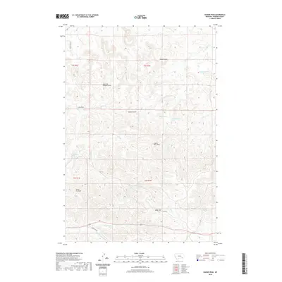
2020 Map of Badger Peak
USGS Topo · Published 2020About this map
Charlie Black Butte and Badger Peak dominate the high ground of this Rosebud County landscape, serving as prominent landmarks in a terrain defined by deep drainage patterns and scattered water sources. This portion of the Lame Deer District is intricately carved by numerous coulees and creeks, including the systems of Alderson Cr and Miller Cr. The map reveals a land where water is a vital and precisely cataloged resource, evidenced by the many named springs like Diamond R Spring and Wood Spring, which supported livestock and early settlement. Narrow roads such as Skyline Rd and Alderson CA Rd follow the contours of the ridges and valleys, illustrating the historical transit routes through the high plains. The transition from Yellow Fox Gulch to the complex branches of Downey Coulee highlights the erosion-carved character of the Montana ranching country.
Find a feature on this map
30 named features on this map. Tap any name to fly to it.
Don’t see what you’re looking for? This feature index may not catch every label — zoom into the map to look around manually.
Map Details
Editions of this 2020 Badger Peak Map
This is the sole edition of this map. No revisions or reprints were ever made.
Other maps of this area

1954 · Hardin
USGS Topo · 1:250,000

1957 · Hardin
USGS Topo · 1:250,000

1958 · Hardin
USGS Topo · 1:250,000

1958 · Garfield Peak
USGS Topo · 1:24,000

1958 · Jimtown
USGS Topo · 1:24,000

1958 · Fisher Butte
USGS Topo · 1:24,000

1958 · Lame Deer
USGS Topo · 1:24,000

1958 · Badger Peak
USGS Topo · 1:24,000

1958 · Hollowwood Creek
USGS Topo · 1:24,000

1971 · Colstrip SW
USGS Topo · 1:24,000