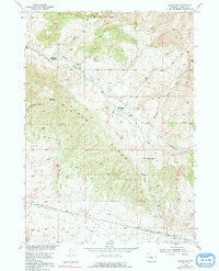
1952 Map of Badwater
USGS Topo · Published 1991About this map
Cedar Ridge dominates this central Natrona County landscape, acting as a high divide between the seasonal drainages of the high desert. Settlement is sparse, represented by isolated outposts like the Hendry Ranch and the Swaim Place, which suggest a ranching economy dependent on the few reliable water sources available. The naming of Badwater Creek and its various tributaries, such as Frenchie Creek and Clear Creek, highlights the importance of water quality in this arid environment. Evidence of early mid-century resource exploration appears in the form of a Derrick and a marked Oil Well (Dry) south of Cedar Ridge. Transportation follows the contours of the land, with the Lost Cabin Arminto Road cutting across the southern portion of the sheet, providing a vital link between remote mountain gaps like Cedar Gap and the distant rail towns.
Find a feature on this map
21 named features on this map. Tap any name to fly to it.
Don’t see what you’re looking for? This feature index may not catch every label — zoom into the map to look around manually.
Map Details
Editions of this 1952 Badwater Map
3 editions found
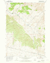
Other maps of this area

1952 · Cottonwood Pass
USGS Topo · 1:24,000

1952 · Badwater
USGS Topo · 1:24,000

1952 · Arminto
USGS Topo · 1:24,000

1952 · Madden
USGS Topo · 1:24,000

1952 · Arminto NW
USGS Topo · 1:24,000

1952 · Lysite SE
USGS Topo · 1:24,000

1952 · Sioux Pass
USGS Topo · 1:24,000

1952 · Badwater NE
USGS Topo · 1:24,000

1952 · Badwater SE
USGS Topo · 1:24,000

1955 · Arminto
USGS Topo · 1:250,000