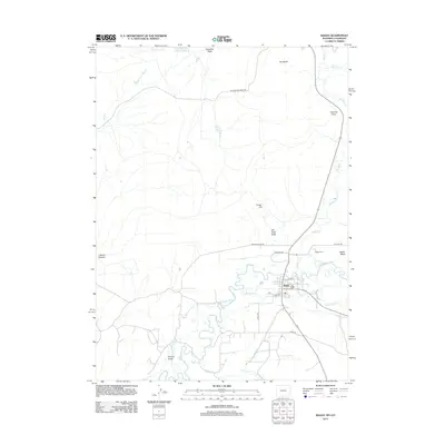
2012 Map of Baggs
USGS Topo · Published 2012About this map
Baggs sits at the heart of this high-desert landscape near the Wyoming-Colorado border, where the Little Snake River meanders through a valley defined by agricultural irrigation and rugged topography. The settlement is anchored by a tight grid of streets like Cedar Dr and Spruce St, while the surrounding basin relies on an intricate network of waterways including the Baggs Ditch, Gibson Blair Ditch, and the West Side Canal. These diversions from the river and Ledford Slough support the local ranching economy against the backdrop of prominent landforms such as Weber Mesa and Tincan Hill. North of the town center, the terrain rises toward The Bluffs and Fivemile Point, where drainage features like Van Fleet Draw and Streckfus Draw carve into the dry earth. This map documents a modern snapshot of a classic Western crossroads, balancing river-bottom agriculture with the vast, open spaces of the Carbon County interior.
Find a feature on this map
31 named features on this map. Tap any name to fly to it.
Don’t see what you’re looking for? This feature index may not catch every label — zoom into the map to look around manually.
Map Details
Editions of this 2012 Baggs Map
This is the sole edition of this map. No revisions or reprints were ever made.
Other maps of this area

1916 · Craig
USGS Topo · 1:125,000

1954 · Rawlins
USGS Topo · 1:250,000

1954 · Craig
USGS Topo · 1:250,000

1957 · Craig
USGS Topo · 1:250,000

1957 · Baggs
USGS Topo · 1:62,500

1958 · Rawlins
USGS Topo · 1:250,000

1958 · Craig
USGS Topo · 1:250,000

1960 · Craig
USGS Topo · 1:250,000

1962 · Rawlins
USGS Topo · 1:250,000

1962 · Craig
USGS Topo · 1:250,000