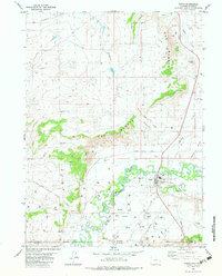
1982 Map of Baggs
USGS Topo · Published 1983About this map
Baggs sits along the winding course of the Little Snake River in southern Wyoming, just above the border with Colorado. This early 1980s survey documents a landscape defined by the intersection of high desert hydrology and modern infrastructure. While the town and the smaller settlement of Ledford occupy the river's floodplain, the surrounding terrain is dominated by prominent landforms such as The Bluffs and Weber Mesa. The map reveals an active resource-extraction economy, marked by numerous drill holes, gas wells, and a Pipeline network cutting across the draws. Dramatic relief is found at Devils Canyon and the Poison Buttes, while smaller water features like Fourmile Spring and Muddy Creek provide essential drainage through the arid breaks of the Little Snake River Valley.
Find a feature on this map
29 named features on this map. Tap any name to fly to it.
Don’t see what you’re looking for? This feature index may not catch every label — zoom into the map to look around manually.
Map Details
Editions of this 1982 Baggs Map
This is the sole edition of this map. No revisions or reprints were ever made.
Other maps of this area

1916 · Craig
USGS Topo · 1:125,000

1954 · Rawlins
USGS Topo · 1:250,000

1954 · Craig
USGS Topo · 1:250,000

1957 · Craig
USGS Topo · 1:250,000

1957 · Baggs
USGS Topo · 1:62,500

1958 · Rawlins
USGS Topo · 1:250,000

1958 · Craig
USGS Topo · 1:250,000

1960 · Craig
USGS Topo · 1:250,000

1962 · Rawlins
USGS Topo · 1:250,000

1962 · Craig
USGS Topo · 1:250,000