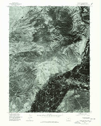
1975 Map of Baggs SW
USGS Topo · Published 1978About this map
Dead Horse Reservoir sits within a landscape defined by sharp elevation shifts and intricate drainage patterns in this 1975 orthophotoquad. Produced from aerial photography taken in late August, the image reveals the complex hydrology of the region, where seasonal watercourses carve deep, branching channels through the terrain. The stark contrast between the high, arid plateaus and the more densely textured lowlands highlights the natural drainage basins that feed into local storage. Unlike traditional topographic maps, this photographic survey captures the exact ground cover and vegetation patterns of the mid-1970s, providing a raw visual record of the land before any subsequent developments or environmental changes altered these Carbon County drainage systems.
Find a feature on this map
1 named feature on this map. Tap any name to fly to it.
Don’t see what you’re looking for? This feature index may not catch every label — zoom into the map to look around manually.
Map Details
Editions of this 1975 Baggs SW Map
This is the sole edition of this map. No revisions or reprints were ever made.
Other maps of this area

1916 · Craig
USGS Topo · 1:125,000

1954 · Rawlins
USGS Topo · 1:250,000

1954 · Craig
USGS Topo · 1:250,000

1957 · Craig
USGS Topo · 1:250,000

1957 · Baggs
USGS Topo · 1:62,500

1958 · Rawlins
USGS Topo · 1:250,000

1958 · Craig
USGS Topo · 1:250,000

1960 · Craig
USGS Topo · 1:250,000

1962 · Rawlins
USGS Topo · 1:250,000

1962 · Craig
USGS Topo · 1:250,000