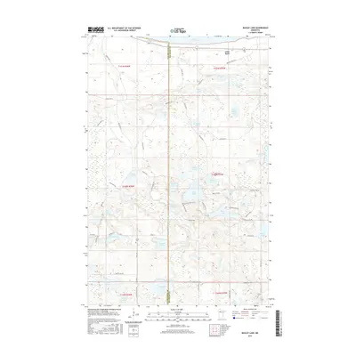
2016 Map of Bagley Lake
USGS Topo · Published 2016About this map
Lower Red Lake dominates the northern horizon of this landscape where Clearwater and Beltrami counties meet. The interior is a dense network of glacial water bodies, from the larger Moose Lake and Morrison Lake to smaller basins like Pickerel Lake and Bender Lake. This hydrological pattern is defined by the Sandy River and Big Rock Cr, which weave through terrain marked by modern forestry access roads and tribal routes.
Find a feature on this map
69 named features on this map. Tap any name to fly to it.
Don’t see what you’re looking for? This feature index may not catch every label — zoom into the map to look around manually.
Map Details
Editions of this 2016 Bagley Lake Map
This is the sole edition of this map. No revisions or reprints were ever made.
Other maps of this area

1919 · Solway
USGS Topo · 1:62,500

1919 · Churnes
USGS Topo · 1:62,500

1943 · Solway
USGS Topo · 1:62,500

1943 · Bagley
USGS Topo · 1:62,500

1954 · Bemidji
USGS Topo · 1:250,000

1957 · Bemidji
USGS Topo · 1:250,000

1958 · Bemidji
USGS Topo · 1:250,000

1969 · Leonard
USGS Topo · 1:24,000

1972 · Bagley Lake
USGS Topo · 1:24,000
1972 · Debs
USGS Topo · 1:24,000