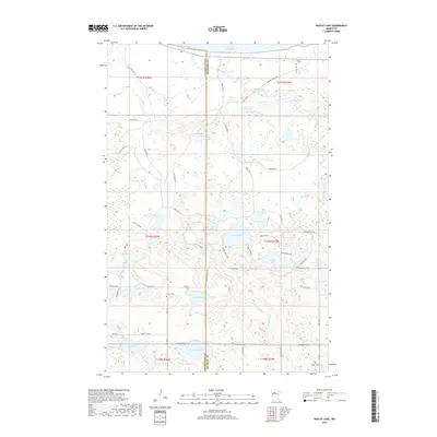
2019 Map of Bagley Lake
USGS Topo · Published 2019About this map
The Sandy River snakes through this section of Beltrami and Clearwater Counties, connecting a dense network of glacial lakes including Sand Lake, Dunbar Lake, and the expansive Lower Red Lake at the northern margin. This landscape is defined by its water and marshlands, where small drainages like Big Rock Cr feed into deeper basins such as Johnson Lake and Graining Lake. The region is primarily managed as reservation land, evidenced by the numbered road system including Resvn Hwy 5 and Resvn Hwy 3. Local history is anchored by the presence of Clover Cem and Trinity Cem, which sit near the more developed road corridors like Co Hwy 11 and Bagley Lake Rd. The transition between the open water of Bagley Lake and the dense wetlands surrounding Fence Lake illustrates the complex hydrology of northern Minnesota's lake country.
Find a feature on this map
67 named features on this map. Tap any name to fly to it.
Don’t see what you’re looking for? This feature index may not catch every label — zoom into the map to look around manually.
Map Details
Editions of this 2019 Bagley Lake Map
This is the sole edition of this map. No revisions or reprints were ever made.
Other maps of this area

1919 · Solway
USGS Topo · 1:62,500

1919 · Churnes
USGS Topo · 1:62,500

1943 · Solway
USGS Topo · 1:62,500

1943 · Bagley
USGS Topo · 1:62,500

1954 · Bemidji
USGS Topo · 1:250,000

1957 · Bemidji
USGS Topo · 1:250,000

1958 · Bemidji
USGS Topo · 1:250,000

1969 · Leonard
USGS Topo · 1:24,000

1972 · Bagley Lake
USGS Topo · 1:24,000
1972 · Debs
USGS Topo · 1:24,000