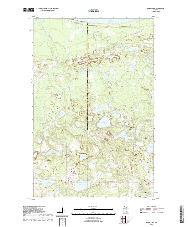
2022 Map of Bagley Lake
USGS Topo · Published 2022About this map
The Clearwater Co Beltrami Co boundary line bisects a landscape defined by an dense network of glacial basins and watercourses just south of Lower Red Lake. This modern-era survey shows the intricate drainage patterns of the Sandy River and Big Rock Creek as they wind through a mosaic of wetlands and timber. The area is characterized by numerous named water bodies, ranging from the large Sand Lake and Bagley Lake to smaller, secluded basins like Fence Lake and Fessland Lake. Local history is anchored by the presence of Clover Cem and Trinity Cem, providing important landmarks for genealogical research. The road network is a mix of county routes and forest tracks, such as the Gonvick Truck Trl and Timberwolf Trl, reflecting the region's managed wilderness and timber heritage.
Find a feature on this map
64 named features on this map. Tap any name to fly to it.
Don’t see what you’re looking for? This feature index may not catch every label — zoom into the map to look around manually.
Map Details
Editions of this 2022 Bagley Lake Map
This is the sole edition of this map. No revisions or reprints were ever made.
Other maps of this area

1919 · Solway
USGS Topo · 1:62,500

1919 · Churnes
USGS Topo · 1:62,500

1943 · Solway
USGS Topo · 1:62,500

1943 · Bagley
USGS Topo · 1:62,500

1954 · Bemidji
USGS Topo · 1:250,000

1957 · Bemidji
USGS Topo · 1:250,000

1958 · Bemidji
USGS Topo · 1:250,000

1969 · Leonard
USGS Topo · 1:24,000

1972 · Bagley Lake
USGS Topo · 1:24,000
1972 · Debs
USGS Topo · 1:24,000