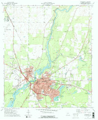
1974 Map of Bainbridge
USGS Topo · Published 1976About this map
The Flint River carves a winding path through the heart of Decatur County, serving as the defining axis for the city of Bainbridge during the mid-1970s. This era shows the community's established infrastructure, anchored by the Courthouse and City Hall, while education and healthcare facilities like Bainbridge Junior College, Hutto Jr High Sch, and Memorial Hospital indicate a regional hub. The transportation network is dominated by the Seaboard Coast Line railroad, which branches through the cityscape, supporting industrial sites such as the Decatur County Industrial Air Park and several sandpits.
Find a feature on this map
63 named features on this map. Tap any name to fly to it.
Don’t see what you’re looking for? This feature index may not catch every label — zoom into the map to look around manually.
Map Details
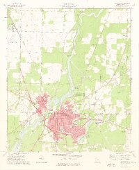
Editions of this 1974 Bainbridge Map
2 editions found
Other maps of this area

1953 · Dothan
USGS Topo · 1:250,000

1954 · Dothan
USGS Topo · 1:250,000

1954 · Tallahassee
USGS Topo · 1:250,000

1955 · Dothan
USGS Topo · 1:250,000

1955 · Bainbridge
USGS Topo · 1:62,500

1955 · Whigham
USGS Topo · 1:62,500

1959 · Tallahassee
USGS Topo · 1:250,000

1960 · Tallahassee
USGS Topo · 1:250,000

1971 · Vada
USGS Topo · 1:24,000

1974 · Boykin
USGS Topo · 1:24,000