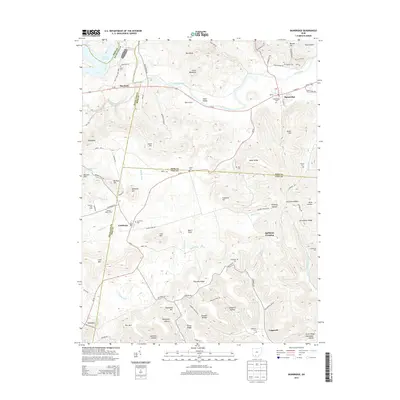
2013 Map of Bainbridge
USGS Topo · Published 2013About this map
Paint Creek and its many tributaries, including Rocky Fork and Baker Fork, define the landscape of this southern Ohio region. The village of Bainbridge serves as a primary center of commerce and residence, situated near the Ross and Highland county line. Higher elevations are marked by numerous named peaks and ridges such as Irons Mtn, Shepherds Mtn, and Greenbrier Ridge, creating a terrain of deep hollows like Whiskey Hollow and Jimtown Hollow. Small, localized settlements such as Cynthiana and Lapperell are scattered throughout, often anchored by historic burial sites like Cynthiana Cem and Lapperell Cem. The presence of Haas Airport near the Paint Valley indicates modern accessibility, while the northwestern corner is occupied by the protected lands of Paint Creek State Park. Extensive road networks like Us-50 and Oh-41 connect these rural communities across the undulating topographic contours.
Find a feature on this map
105 named features on this map. Tap any name to fly to it.
Don’t see what you’re looking for? This feature index may not catch every label — zoom into the map to look around manually.
Map Details
Editions of this 2013 Bainbridge Map
This is the sole edition of this map. No revisions or reprints were ever made.
Other maps of this area

1912 · Roxabell
USGS Topo · 1:62,500

1914 · Roxabell
USGS Topo · 1:62,500

1915 · Bainbridge
USGS Topo · 1:48,000

1915 · Piketon
USGS Topo · 1:62,500

1917 · Bainbridge
USGS Topo · 1:62,500

1917 · Piketon
USGS Topo · 1:62,500

1917 · Greenfield
USGS Topo · 1:62,500

1944 · Piketon
USGS Topo · 1:62,500

1944 · Greenfield
USGS Topo · 1:62,500

1944 · Roxabell
USGS Topo · 1:62,500